Top to Bottom
|
| Go
to Part: 2 3 4 |
More Canoe Stories |
Part 2 |
In late July of 2004 I embarked on a solo canoe journey into Woodland Caribou Provincial Park in Ontario Canada. This would be my seventh trip into the park and I wanted to visit some parts that I had not seen before. I chose to enter from the Wanipigow River in Manitoba. I had entered that way on a dry fall day a few years before and we had to pull our canoes through a lot of sections. I knew the water was higher this year but even if it was another dry year I would have endured having some low water on my first day’s travel and used the Wanipigow. I felt it was a small hindrance to enter by the back door into a seldom used part of the park. I did not see another person until four days later when I entered Welken Lake. All of the UTM coordinates listed are NAD 27 in the 15 U zone.
Day One- Wallace to Crystal
As I loaded my canoe at the Wallace Lake Campground a couple from Germany were dropped off by a shuttle service. They were heading up the portage from Siderock to Obukowin so I offered them a look at an E-mail that I had received from Jim Dickieson. Jim is the trapper who keeps these portages open to run his wintertime traplines. I was not surprised when their information did not match what Jim described. At the end of my trip I planned to travel these portages and write a story for the (canoestories.com) web site that Jim Hegyi maintains. For maps and the straight scoop on these three portages see the story. (adobe acrobat .pdf)
To get to Siderock Lake I took the snowmobile trail that exits Wallace Lake on the eastern tip. It was a flat .8 mile trek to Siderock. I would have preferred traveling the Wanipigow River but a strong SE wind made the portage the easier option. When you are double tripping your gear it takes the same time on the winding river or the portage. You want to allow 2.5 hours for the trip to Siderock where there are some good campsites. UTM coordinates are 15 U 341688 5650921, 342240 5651118 for the camps.
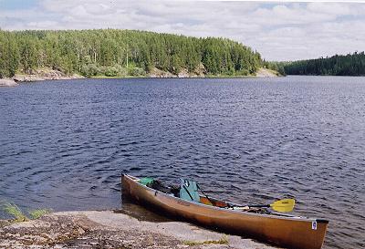
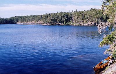
At the east end of Siderock I knew to stay in the middle of the lake and head through the weeds there until I spotted the higher grass on the banks of the river. Stay in the middle and head in and you will be OK. I only had to pull over one beaver dam before I got to the first portage. There was just enough water that I was able to pull my canoe through the rocks in the next section that sometimes you need to portage around or over. In four hours I had reached the no name lake and elected to push on rather than camp at spot in the Birch trees on the north shore.347449 5650051 I entered the long narrow bay in the SE corner of the no name lake and was able to paddle right up to the 50 meter portage. 348138 5649714 During lower water years you have a pull through deep boot sucking mud at this spot. Otters were hunting the creek when I got to the other side of the portage and I paused for a while to enjoy them. In 6.5 hours I was setting up camp on the west end of Crystal Lake on a very nice campsite. 350532 5649349 A beautiful sunset made for a great first night out and I spent some time soaking in my surroundings.
Day Two- Crystal to Haggart
Rain falling on my tent awakened me but with yesterdays drive I had little trouble dozing off for a while longer. When I finally rolled out the rain had stopped and I fixed breakfast and broke camp with only a few mosquitoes to pester me. I chose to paddle the river to Broken Arrow Lake since I had traveled the long portage on a previous trip. The portage to the river access was near my camp but I found it further east than it appears on the park map. 350677 5649239 Between the portage and the river there were numerous places that would make good campspots. By the time I reached Broken Arrow I was wishing I had taken the portage. There was a good current coming at me and with all the sharp turns I had to do a lot of work to make my way. With a tandem canoe it is not quite as bad because the paddler in the bow can help draw you around the corners. With the solo canoe the current would force the front of the canoe the wrong way every time you entered a turn. It took me an hour and a half to get to Broken Arrow on this river that mostly only allows you to see high grass as you travel through. On the other hand the portage is a very scenic and invigorating climb.
It was a peaceful paddle down Broken Arrow to the portage to Haggart. I had seen my only Caribou on Haggart so I was keeping a sharp eye all around. A white spot on a rock ledge turned into an eagle when I focused my binoculars on it. A second eagle soon showed up and further along a loud Tern and six loons added to my day. The portage crew had been through lately and the leaves had not even dried from the brush that was cut on the portage to Haggart. There are advantages to visiting a spot for a second time and that is why I knew I would have blueberries on the top of the portage. It was a leisure paddle down Haggart Lake. The day was nice and I was down to my swimsuit so when some rain moved over I just kept going. The rain turned to a downpour and cold wind started whipping across the lake. I spotted a small shelter made by the sod that had been lifted into the air when a tree had blown down with its roots still attached. In five minutes I went from swimsuit to poly and Goretex and still shivered. I made camp in the narrows on the south end of Haggart Lake. 360929 5634922
After dinner and the other camp chores I went back north onto the main body of the lake to find some bugless breezes. I scanned the shore line with my binoculars and upon coming full circle spotted a young eagle about 30 meters away. Soon there were five eagles soaring in the area. As I sat in my canoe writing in my journal I heard the now familiar snort of an otter. I turned to watch his protest until the wind carried me far enough away.
Day Three- Haggart to Irregular
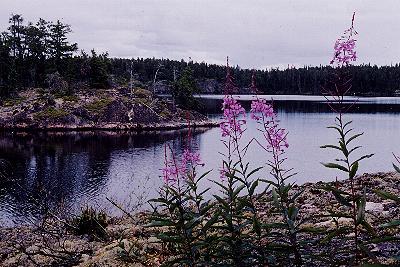
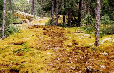 After a leisurely breakfast I did the steep portage out of Haggart and heading toward Mather. A drizzling rain returned as I made my way past Caribou tracks and torn up moss and lichen on the 475 meter portage into Mather. By lunch time I was on Irregular Lake and the rain had stopped. Irregular Lake lacks the high rock of Haggart but the immensity and the solitude more than make up for it. As I cruised along I saw no fire rings and a few boat caches were the only sign of man I noted. There was a steady wind blowing but there are so many islands and peninsulas that I easily made my way to the 500 meter portage on the south end. I walked the portage to add a little variety to my afternoon and was happy that I did not have to haul loads over the treacherous footing.
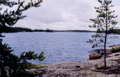
Having reached one of my goals by getting to the southern boundary of the park I paddled to the NE corner of Irregular using the islands for cover in the wind. I selected a spot on an eastern facing point to camp. If there was a bright sunrise I wanted to see it. The bugs were pesky but I stayed anyway. A rock not too far away seemed to be the hangout for a lot of very noisy terns. I spent the evening enjoying the solitude that this lake provided. It would be a great place for a kayaker to be flown into. They could enjoy paddling the multiple passages on this lake for days.
 Day Four-Irregular to Welken
I awoke early enough to see a thin red line on the horizon. The heavy cloud cover above assured me there would be no dazzling sunrise. I half heartily threw a hot pink Dardevle into the lake but soon set it aside. The lake is in somber and calm mood. The terns are still making a racket in the air above. After coffee and Red River cereal I headed east toward the 825 meter portage. A float plane had gone over about six going north so the next plane I saw going south was probably the same plane on its return trip. I passed a rock covered with gulls. They were mostly Ring-billed gulls but there were a few of the larger and longer beaked Herring gulls. I stopped at a great
campspot 362806 5626051 on a smooth rock point. It has a nice view of the lake and plenty of breezy open areas along with a lot of shelter back in the trees. It was nice during my tour around Irregular not to see man made fire rings on the abundant potential campspots. As I travel these waters I get more and more upset about all the fire rings. There are so many natural fire pits that they are unnecessary.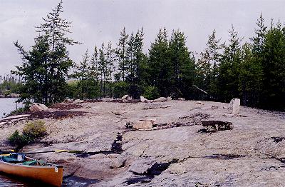
The 825 meter portage is not as nasty as the 500 meter going south but it is still a difficult one. There are some steep inclines to make your way up and down on. When I got to Beamish I used the hot pink Dardevle my friends had sent me to catch Northern for lunch. I went to a campspot across from the portage and had a nice shore lunch. So much so that I felt like taking a nap. From the lack of fire rings I would say that the southern end of Beamish doesn’t see many people. There is a 20 meter portage between Beamish and Welken and I figured I would see people after I crossed it. Sure enough there were two people camped on an island in the middle of Welken. I was able to camp so that an island protected both of our scenic views. I hauled water back in the woods and took a bath and did my laundry. The big shore lunch had not allowed my appetite to return so I ate a little and took dessert with me as I headed out for an evening paddle.
 Welken Lake has not burned for a long time and with the high rock walls it is a big switch from where I have been. I enjoyed the burn areas but it was nice to be back in old timber again. As I paddled the eastern arm of the lake I spotted a bear with two cubs. Mama was apparently looking for blueberries. She would rush up to a clump and nose around quickly head out again.
Day Five –Welken to Adventure
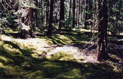
I awoke this morning to a glass smooth lake spread out below my camp high on a dome of rock. With the calm I also had a fair crowd of mosquitoes. At 7:30 I headed north toward Adventure Lake. Now, that has a certain allure to it. I took the first load across the 550 meter portage and munched blueberries on the way back. With the second carry I set the canoe against a tree half way across. It is a tough portage and ends with a steep decline and I wanted fresh legs for that. The ample blueberries and being in the middle of a scenic forest made for one of those special experiences in Woodland Caribou.
 The next portage was marked as 350 wet and that caused me to sit in there a while longer and enjoy a feast of beauty and berries.
As I approached the next portage I could see a dark tunnel through the spruce at the end of the lake which had to be the wet portage. Before getting there I spotted fresh blaze marks on the western shore. I pulled over and headed uphill on this new portage elated that at least the whole portage was not going to be wet. After climbing up and down for what I knew had to be over 350 meters I set my load down with no water in sight. On the way back I came up with the brilliant idea of taking the old wet portage with the other pack and canoe rather than what I thought was a very long bypass. I paddled to the tunnel in the trees and pulled my canoe across some bog and smugly hit the moose trail like portage. Soon I was trying to maneuver around fallen timber on slippery rocks and bad trail. I persevered to the end and it was shorter but treacherous. I looked around for the bypass portage and soon realized it did not end at the same spot. After checking the shoreline in the bay I turned my GPS on and viewing the map on screen showed me that the portage might end in the nest bay to the west. I went around a point and found the end of the new portage.
 I hiked up into forest and retrieved my gear. The UTMS for this new portage are 369310 5636678---368968 5637167. It is about 650 meters of strenuous but high and dry walking. It is not on the map available in 2004 so take note especially if you are coming from the north. So I had a little adventure on the way to Adventure Lake but I advise that you stick to the new portage and enjoy another great walk in the forest of Woodland Caribou.
A great campspot on Adventure Lake has drawn me to set up camp early and explore with an empty canoe. 369135 5640663 It is a bit of a climb but the view is worth it. I have some friends that may have camped on Bulging today so I headed up that way. I met a couple on a portage and I was the first person they had seen in 6 days of travel in the western part of the park. Time ran out before I got to Bulging Lake but I was able to see some more country I had not seen before. The sun was out most of the time but then the skies closed in and it rained for about and hour. The sun was back out but then it drizzled again as I fixed supper. The changing weather is a part of a canoe trip and I was glad that I had brought along a tarp this time. A little more weight but a big lift for your spirits on a rainy day.
| Go
to Part: 2 3 4 |
More Canoe Stories |
Part 2 |
Copyright 2004 by Martin Kehoe- http://www.canoestories.com/kehoe/top_to_bottom1c.htm